By Janice Mathews
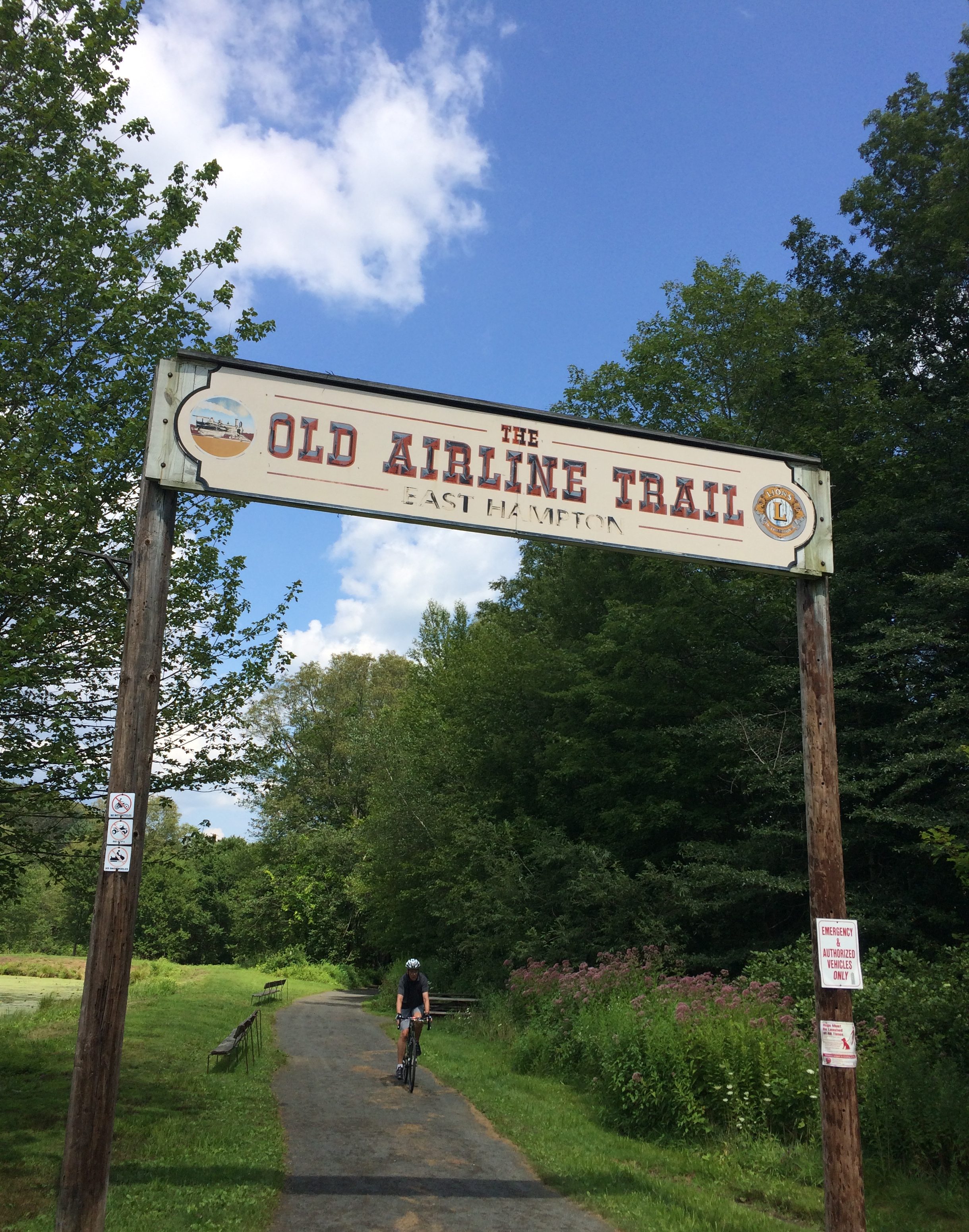
Air Line State Park Trail entrance, East Hampton. photo: CT Explored
(c) Connecticut Explored, SUMMER 2008
Subscribe/Buy the Issue!
Most hiking trails in Connecticut have pretty views of some sort, but how many pass over a span of wrought iron 1,112 feet long and 137 feet high? Just one that we know of: the Air Line State Park Trail (South Section). The Air Line Trail is one result of that most wonderful of reuse initiatives, the rails-to-trails movement that has converted disused railroad track beds into linear parks for hiking, biking, skiing, and communing with nature. Some rail trails, like Air Line, also offer opportunities to commune with great feats of engineering.
A plum goal for enterprising 19th-century railroad tycoons was to connect Boston and New York with rails running between the two cities “as the crow flies.” The Air Line Railroad was built in 1873 to connect passengers and freight straight through Eastern Connecticut. Though this entailed going over dense rock ridges and deep valleys, a little thing like geology was not allowed to stand in the way of progress. The engineers came in, and the Air Line Railroad was the result, operating in various forms for more than 80 years. (Some small sections are still in use).
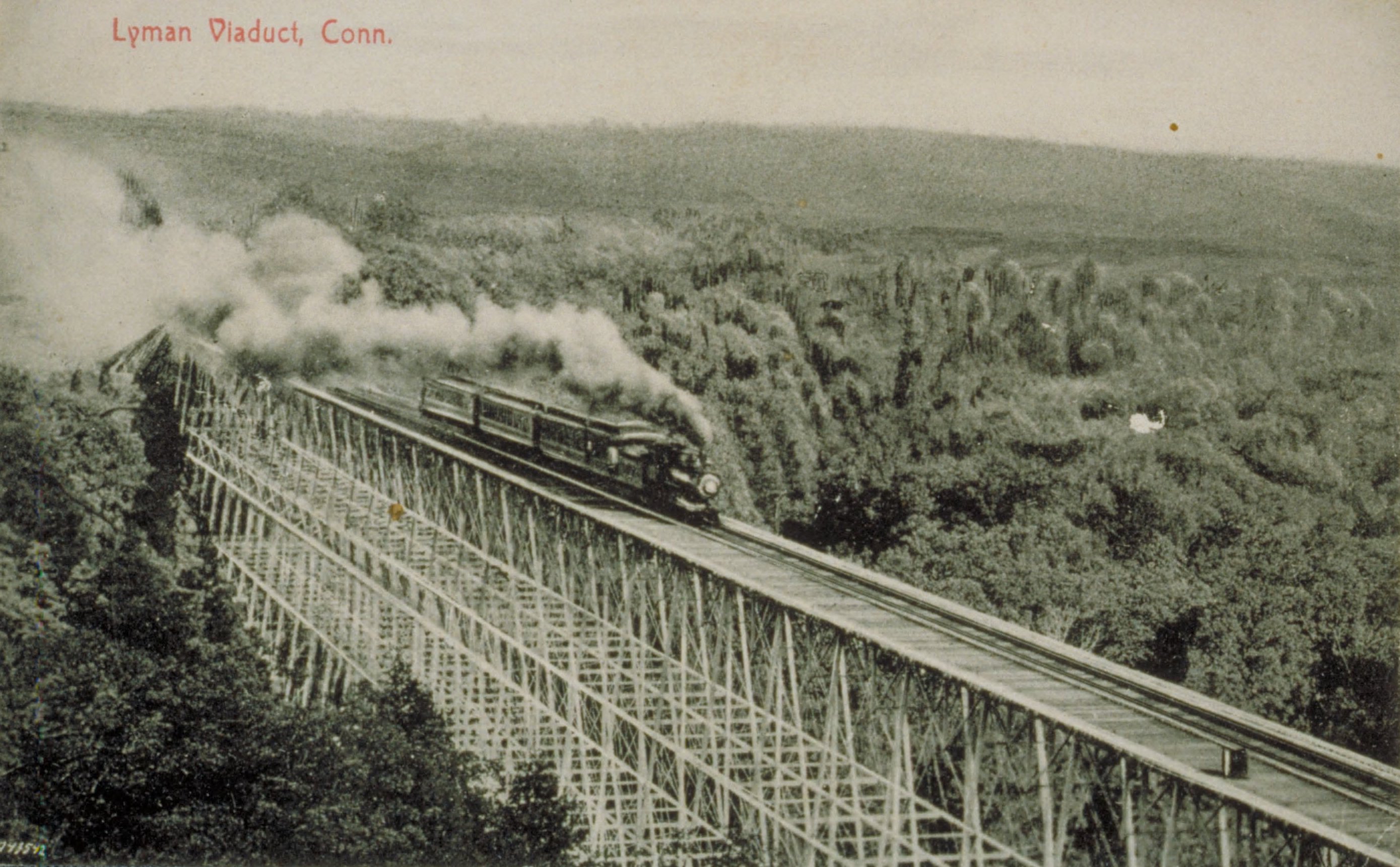
Postcard of the Lyman Viaduct before it was buried in sand and gravel in 1912-1913.
Among the infrastructure elements required to build the Air Line Railroad were viaducts, or bridges that are often exceptionally long and composed of smaller spans. Viaducts date back to the Romans and are used to move water, people, and goods over the tricky bits, such as plummeting chasms, of a desired route.
One such tricky section, the steeply sloped Dickinson Creek in Colchester, was spanned by the Lyman Viaduct (named, presumably, for one of its leading investors, David Lyman). The viaduct was such an impressive structure that it drew tourists and picnickers, who walked from the nearest train station to take in the view of it and from it. The viaduct was built with five tiers of a new design of deck trusses called Phoenix Columns: hollow wrought-iron arched segments that when joined together were both strong and flexible. What started as a means of getting people quickly through Connecticut became a popular destination in itself in the late 1800s.
After 1900, trains began carrying heavier and heavier loads, and the Lyman Viaduct’s open ironwork was deemed insufficiently safe. The railroad decided to stabilize the track by filling in around the immense viaduct with sand. For twenty months between 1912 and 1913 the span was filled with 20 acres of sand. The good news is that today this amazing structure is still intact, substantially unaltered and beautifully preserved, which is extremely rare for this generation of wrought-iron viaducts. The bad news is that it’s buried up to its train track, with only portions still visible sprouting from the ground.
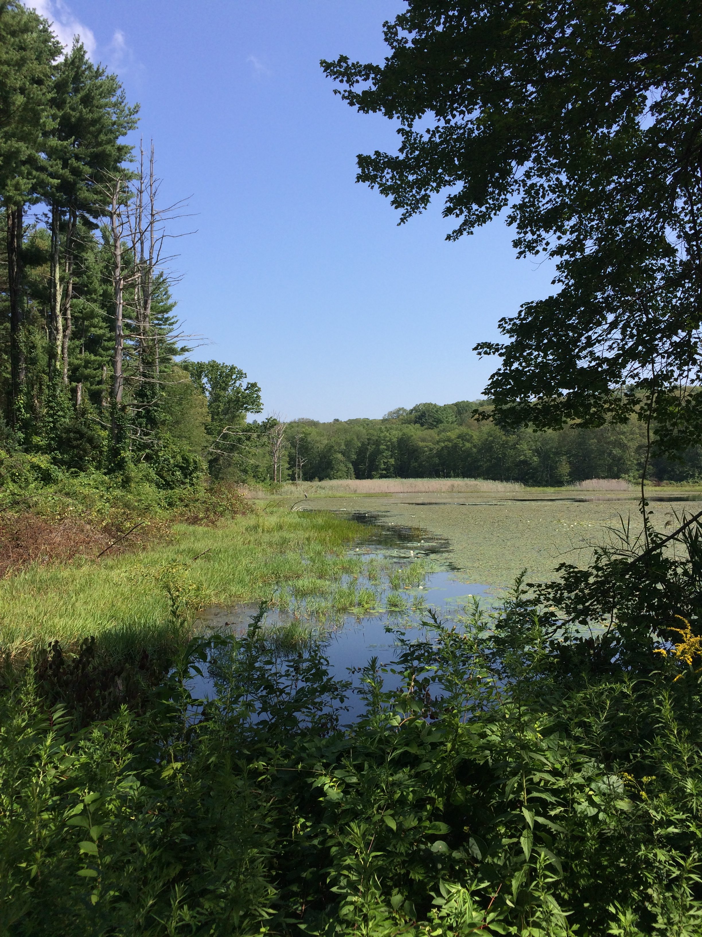
View from the Air Line Trail, East Hampton. photo: CT Explored
Buried but not forgotten, the viaduct serves as a reminder of the importance of the railroad industry in Connecticut and the lengths to which owners would go to get the trains through. And as a State Archaeological Preserve and state park, the Lyman Viaduct still attracts visitors, who flock to see the view of it and from it.
Explore!
For directions and more information about the Air Line State Park Trail visit the DEEP’s website at http://www.ct.gov/deep/cwp/view.asp?a=2716&q=479336&deepNav_GID=1650
Read all of our stories about the historic Connecticut landscape on our TOPICS page
Read all of our stories about travel & transportation history by clicking on the Travel & Transportation category link at the top of the page.
LISTEN!
Listen to our podcast about the Air Line Trail in episode 36 of Grating the Nutmeg